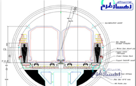
L2 STATION, LINE 2 METRO OF ISFAHAN, ISFAHAN, IRAN (L2S-L2MI)
FACTORS DESCRIPTION SERVICES Construction and Supervision, Engineering and Design NAME OF PROJECT L2 station, line 2 metro of Isfahan EMPLOYER / CLIENT Isfahan Urban Railway Organization (IURO) CONTACT INFORMATION OF THE EMPLOYER Website address: https://ghatarshahri.isfahan.ir/ Email: info.metro@isfahan.ir Phone No: (0098) 31 34358410 CONTRACT NUMBER 125/96 TYPE OF CONTRACT Design and Build (DB) CONTRACT DURATION Ongoing CONSTRUCTION METHOD NATM, Rib-Pile, Top-down, Braced secant piles with diagonal struts DATE OF START July 2017 DATE OF FINISH Ongoing DURATION OF THE PROJECT 6 years and 6 months (ongoing) KEY PROJECT CHARACTERISTICS · Geometry design: a three-story station configuration (25.55 m height) with three-arched roof is proposed, consisting of a ticket hall (35 m width), a middle story (22.5 m width), and a platform story (22.5 m width) · Excavation method = NATM, Top-down · Line alignment = -30.5 m · Overburden = 8 m · Type of retaining wall for ticket hall = Rib-pile, frame · Type of retaining wall for technical story = Secant pile, strut · Type of retaining wall for platform story = Secant pile, strut · Dimensions of ticket hall = 40.42 m width with 6 m depth · Dimensions of technical story = 23.6 m width with 5.18 m depth · Dimensions of platform story = 23.6 m width with 11.35 m depth · Width of platforms = Each of them 7.4 m, together 14.8 m · Effective width of station = 20.92 m · Number of rib-piles = 110 · Number of secant piles = 220 · Number of struts = 100 · Height of secant pile = 17 m · Main lithology and geological unit = Fine-grained with the middle layer of coarse-grained CHALLENGES AND DIFFICULTIES · The station is situated in one of the cultural heritage areas in Iran, where excavation on the surface is not permitted due to cultural heritage regulations. Therefore, all excavation and construction processes must be conducted underground. · The Zayandeh rood river traverses the central region of Esfahan, causing the groundwater level to be significantly high, and leading to the platform and middle stories to be completely submerged. · The station is built through clayey soil materials, with a middle layer consisting of coarse-grained materials that have high value of hydrodynamic factors such as transmissivity and coefficient of permeability. As a result, the pumping and dewatering operations are unable to decrease the underground water level as proven by a 24-hour pumping test which only resulted in a low reduction in the water level. · L2 station is a link tunnel with metro line 1, which is subject to floor level limitations requiring access to the desired depth on line 1. · The station serves as a link between line 1 and line 2 of the Esfahan metro. This is why the width of the station has been designed to be larger than the usual measurements, with a maximum width of 41 m and a minimum width of 24 m. There are two main reasons for this decision. First, there is a high demand for transferring passengers between these two lines due to a dense population. Second, side structures need to be integrated into the main structure, requiring additional space. · Braced secant piles and diaphragm walls from the ground surface is considered the most effective approach to mitigate groundwater issues. However, the station is situated in one of the cultural heritage areas in Iran, where excavation on the surface is not permitted due to cultural heritage regulations. · Although the station has an overburden of 30 m, the retaining wall of the station has an overburden of 8 m. DESCRIPTION OF SERVICES · The collection of data and conducting of foundational studies encompass various components: · The meticulous examination and identification of general physical characteristics and regulations · Investigation and study of building materials and construction methods · Scrutiny of the building services system and evaluation of necessary equipment · Architectural planning · The formulation of schematic designs and preparation of detailed reports. · Phase 2 studies encompass a comprehensive examination of architectural, structural, electrical, and mechanical systems. SOLUTION TO OVERCOME OBSTACLES · During the excavation process, it is advised to avoid using water pumping and dewatering techniques since they are not efficient ways for this specific project. Instead, a watertight wall (braced secant piles) should be constructed above the level of the groundwater to prevent water infiltration. · A three-slab station configuration with three-arched roof (25.55 m height) is proposed, consisting of a ticket hall (35 m width), a middle slab (22.5 m width), and a platform (22.5 m height). The ticket hall (top) slab houses the side structures and equipment such as RS and LPS, while the middle slab serves as a ventilation space. · The consideration of a three-story station design was prompted by the necessity for an interchange station with metro line 1, which is subject to floor level limitations requiring access to the desired depth on line 1. · In order to address the limitations regarding the performance of braced secant piles under the ground (in case of required equipment), a creative method was employed, involving the construction of two equipment galleries (above the underground water surface) to provide sufficient space for these piles. The crown of the tunnel is strategically positioned above the area where Braced secant piles need to be executed, ensuring adequate height and space. · During the operational stage, the braced secant piles were positioned 1.5 meters lower than the design measurement, resulting in a gap between the secant pile and the foundation of the ticket hall. This gap is filled with a pile cap to effectively connect these two structures. · The middle slab is then excavated using the new Austrian tunnelling method (NATM). It is necessary to perform strut to further enhance the stability and support of the top slab of the ticket hall. · Controlling and checking the process of excavation and construction. ACHIEVEMENTS · Introducing an innovative geometry design for construction this station (a three-slab station configuration with three-arched roof is proposed, consisting of a ticket hall (35 m width), a middle story (22.5 m width), and a platform story (22.5 m width)). · Formulating distinctive design following numerous brainstorming sessions as an innovative approach to construct the subway station in the central core of the historical area of Esfahan (fifty-thousand-year-old civilization and the historical capital of Iran) and underground water level. · The successful execution of an excavation and construction project for a L2 station with a larger cross-section than typical stations, necessitating the application of advanced techniques and distinctive designs, stands as a remarkable achievement. · Successfully performing three types of excavation methods including rib-pile (top slab), NATM, and top-down. · Employing a creative method, involving the construction of two equipment galleries (above the underground water surface) to provide sufficient space for Braced secant piles cause the excavation on the surface is not permitted due to cultural heritage regulations. · The construction methodology of the station harmoniously aligns with the architectural aspects, ultimately resulting in a mutually enhancing and complementary integration. · The station construction methodology has contributed to the creation of a unique architectural approach, wherein the architectural elements seamlessly align with the execution technique, thereby ensuring a harmonious integration of design and implementation. · The operation of underpass proceeded without causing any disruption. · Successfully evaluated the difficulties, challenges, and potential risks, ensuring its safety and mitigating potential damages. · Successfully controlled and minimized the risk of ground settlement, ensuring stability and safety during the construction process. · The approved settlement amount during the design phase closely matched the actual conditions experienced in the field · The results achieved from numerical modelling satisfactorily matched the operational stage. · The successful implementation of this innovative project within a historic context and beneath underground water, and with consideration for permissible settlements, was achieved through the utilization of a combination of various drilling methods, the use of braced secant piles, struts, and the top-down technique.
July 2017
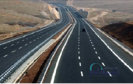
REHABILITATION OF KARASF-SOHREVARD ROAD, ZANJAN, IRAN (KSR-Z)
Factors Description Services Engineering and Design, Construction Supervision Name of Project Rehabilitation of Karasf-Sohrevard Road Employer / Client IMIDRO Contact Information of the Employer Website address: imidro.gov.ir Email: info@imidro.gov.ir Phone No: 0098 2141868000 Contract Number 12657, 114660/1402 Type of Contract Design and Build (DB) Contract Duration Ongoing Date of Start Jul 2022 Date of Finish Ongoing Duration of the Project Ongoing Key Project Characteristics · The axis measures 328+14 kilometers, undergoing renovation from kilometer 911.22+3 to kilometer 800+6, and rehabilitation from kilometer 500+6 to kilometer 139.77+11. · When designing the cross-sections for this project, the traffic volume for each axis was taken into consideration. It was decided to configure the section for renovating the route as a two-way line, with each line having a width of 3.6 meters. Additionally, for the rehabilitation section of the route, the decision was made to expand the width of the existing axis road from the west side. · Following the regulations for out-of-town roads, this route is classified as a collector and distributor road, with a maximum design speed of 80 kilometers per hour. · Traffic estimates were the basis for determining the appropriate pavement structure for the first 10 years of this project. It consists of 4 layers with the following specifications: a 15cm subbase layer, a 15cm base layer, and two layers of asphalt comprising 6cm binder and 4cm wearing course. Challenges and Difficulties · Private land ownership · The incapacity to relocate the axis from its current position and the requirement to renovate the current route owing to social and economic consequences of altering and varying paths Description of services Studies: · The initial phase of the project involves comprehensive studies of traffic flow, road construction, geology, hydrology, and environmental impact. · This also includes the detailed design of plan, profile, and cross-section maps in various stages. Additionally, the estimation of traffic flow for the axis over the next 20 years will be carried out with a prediction of the necessary road construction designs for the axis. · Accompanying these studies is the preparation of assessment maps needed for land acquisition, as well as the creation of signage and safety maps designed to enhance the safety of both new and existing routes. Geometric corrections and the design of route intersections will also be addressed. Supervision: · The supervision phase will encompass pre-construction oversight, along with technical and support supervision during the construction period. Furthermore, post-construction supervision will be provided to ensure project completion and guarantee its successful operation. Solution to Overcome Obstacles · Optimizing the approach and method for improving road infrastructure · Modifying the design to align with future urban expansion plans along the corridor and in the cities along the route · Establishing the capability for the collective use of mining access roads as an integral aspect of national highway development Achievements · Enhancement of traffic flow · Mitigation of heavy vehicle congestion and reduction of pass-through traffic within urban areas · Minimization of vehicular wear and tear · Enhanced accessibility and heightened operational efficiency within regional mining sites
Jul 2022